








Few ships changed naval warfare as dramatically as the Civil War ironclad Monitor, famous for its rotating gun turret, and few wrecks are as hard to visit. Resting about 240 feet down off Cape Hatteras, North Carolina, the vessel has long challenged divers and archaeologists. A 2025 sonar survey produced the sharpest images and three-dimensional models ever made of the wreck, and the public finally saw them. This article explains how the survey worked, what it shows, why the recovered turret still matters, how industry expertise made it possible, and what the results mean for underwater heritage.
How Northrop Grumman and sanctuary researchers scanned the Monitor wreck in full 360 degrees in 2025
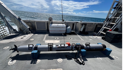
According to the National Oceanic and Atmospheric Administration, researchers at Monitor National Marine Sanctuary partnered with engineers from Northrop Grumman in September 2025 to complete the highest-resolution scan of the historic shipwreck ever conducted. The team deployed a compact uncrewed underwater vehicle equipped with micro synthetic aperture sonar, a system able to produce detailed images even in low-visibility conditions. According to WAVY, the team used the underwater vehicle to complete 360-degree scans of the wreck site, and the work was made possible through a partnership between the agency and Northrop Grumman. The sanctuary’s field note adds that the survey captured fine-scale views of the wreck and its surrounding debris field, along with high-resolution detail of components such as the vessel’s keel.
Why the Monitor remains in fantastic shape and what the sharpest scans reveal about its wrecked hull
The results delighted the scientists who know the site best. Tane Casserley, a maritime archaeologist with Monitor National Marine Sanctuary, told WAVY that the scans confirm the ship remains in “fantastic shape” despite its depth and the passage of time. He described the data as a great baseline for seeing what is happening at a wreck that is deep, difficult to visit and limited for scuba divers. In the sanctuary’s own field note, Casserley told readers that this was the first modern sonar survey to deliver such resolution of the Monitor’s hull remains and internal structure. The dataset also includes environmental observations and three-dimensional digital reconstructions, which the field note says will help researchers track change over time while documenting the fragile site without disturbing it.
How the salvaged turret and conserved artifacts at the Mariners’ Museum complete the Monitor’s story
WAVY reports that major pieces of the ship, including its iconic turret, have been recovered and are conserved in Newport News, Virginia, while much of the vessel remains on the ocean floor, where it is notoriously difficult to study. The Mariners’ Museum continues to house the recovered artefacts, so visitors can see history in person even as the new scans show what remains below. The sanctuary’s field note explains that the wreck, discovered in 1973 and designated in 1975 as the nation’s first national marine sanctuary, now serves as both a cultural resource and a thriving artificial reef. No current plans exist to raise more large-scale pieces of the ironclad, so remote, non-invasive mapping is the main way to study what remains.
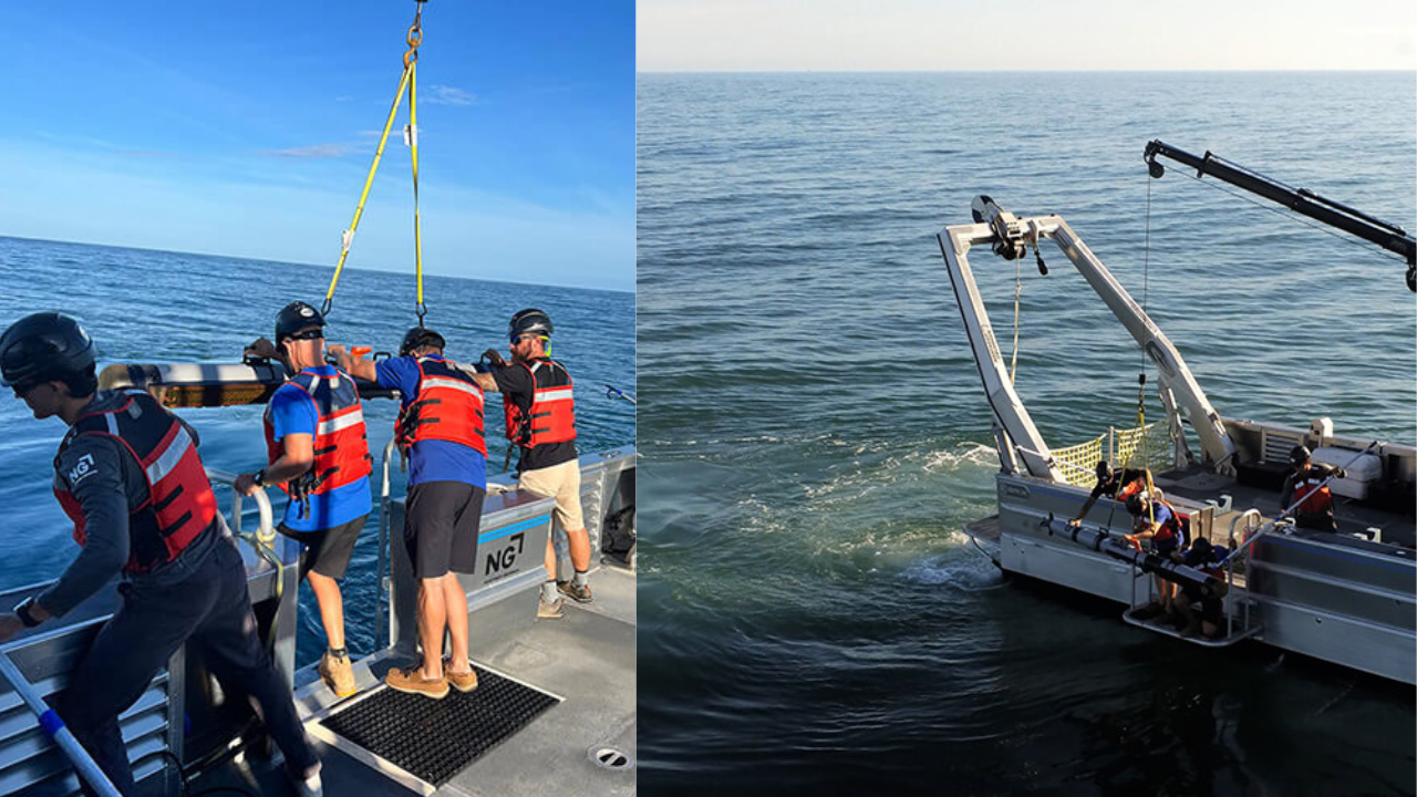
Northrop Grumman deployed the uncrewed underwater vehicle from their research vessel at Monitor National Marine Sanctuary (Image: Reese Bland/NOAA)
How Northrop Grumman’s conservation technology effort brought defence sonar to cultural preservation
Mike Witt, chief environment, quality and safety officer at Northrop Grumman, told WAVY that the company develops technology to meet national security needs and then applies it to other purposes, including work with the National Oceanic and Atmospheric Administration and organisations such as the Chesapeake Bay Foundation. He said the company has launched more than seventy conservation and preservation projects, ranging from understanding wildfires to environmental conservation and cultural preservation such as this one. The sanctuary’s field note links the Monitor survey to the company’s Technology for Conservation initiative, which applies engineering expertise to conservation efforts. Kevin Gallagher, a key engineer on the sonar team, told readers of the field note that the technology had never before been used in a way that made the data publicly available.
What the public unveiling in Newport News means for children, archaeologists and thousands of wrecks
The Mariners’ Museum and Park in Newport News unveiled the new digital products to the public on March 7, 2026, where the sanctuary planned interactive displays and visualisations. WAVY reports that experts consider the sonar technology a game-changer for maritime archaeology, offering a blueprint for exploring thousands of other shipwrecks without disturbing the sites. Casserley told WAVY that history no longer has to be a static drawing, an old photograph or a painting when talking to children, because the three-dimensional model comes alive. According to the field note, Gallagher added that the imagery assists the agency in collecting biological data to identify species around the wreck, and that all data products are being transferred to the agency for public use.