








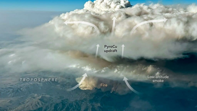
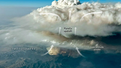
A wildfire in Utah has become the focus of an unusual airborne investigation, after towering clouds of smoke and hot air pushed towards the upper reaches of the atmosphere. Nasa aircraft are chasing these smoke-filled formations to understand what happens when an intense fire effectively starts generating its own weather. The clouds, known as pyrocumulonimbus or pyroCb clouds, can rise high above a burning landscape, produce lightning, hail and heavy rain, and carry smoke and gases into the stratosphere. The investigation centres on the Widemouth 2 fire, which intensified sharply on August 2 after being ignited by lightning days earlier. Nasa’s Aqua satellite spotted two powerful pyroCb bursts above the blaze, while an aircraft later followed the drifting plume and sampled smoke about 12 kilometres above the ground. The flights are giving scientists a rare look inside these clouds and helping explain why some wildfires produce them while most do not.
How giant fire clouds over Utah can punch wildfire smoke high into Earth’s atmosphere
Pyrocumulonimbus clouds form when the extreme heat of a wildfire drives powerful currents of warm air upwards. As the rising air interacts with moisture and becomes unstable, it can develop into a tall convective cloud packed with smoke. The largest examples can produce lightning, hail and heavy rain, turning what began as a wildfire plume into a weather-making system of its own. As per Nasa, these clouds can also carry particles and gases into the stratosphere, where the atmosphere is much drier and more stable.That upward movement is what makes pyroCbs different from an ordinary smoke plume. Instead of remaining relatively close to the surface, parts of the cloud can surge towards the upper troposphere and, in some cases, into the stratosphere. The largest clouds can leave smoke suspended at high altitude for months or even years, with the material potentially spreading around the planet. Their effects are therefore not limited to the immediate area around a burning forest or grassland.
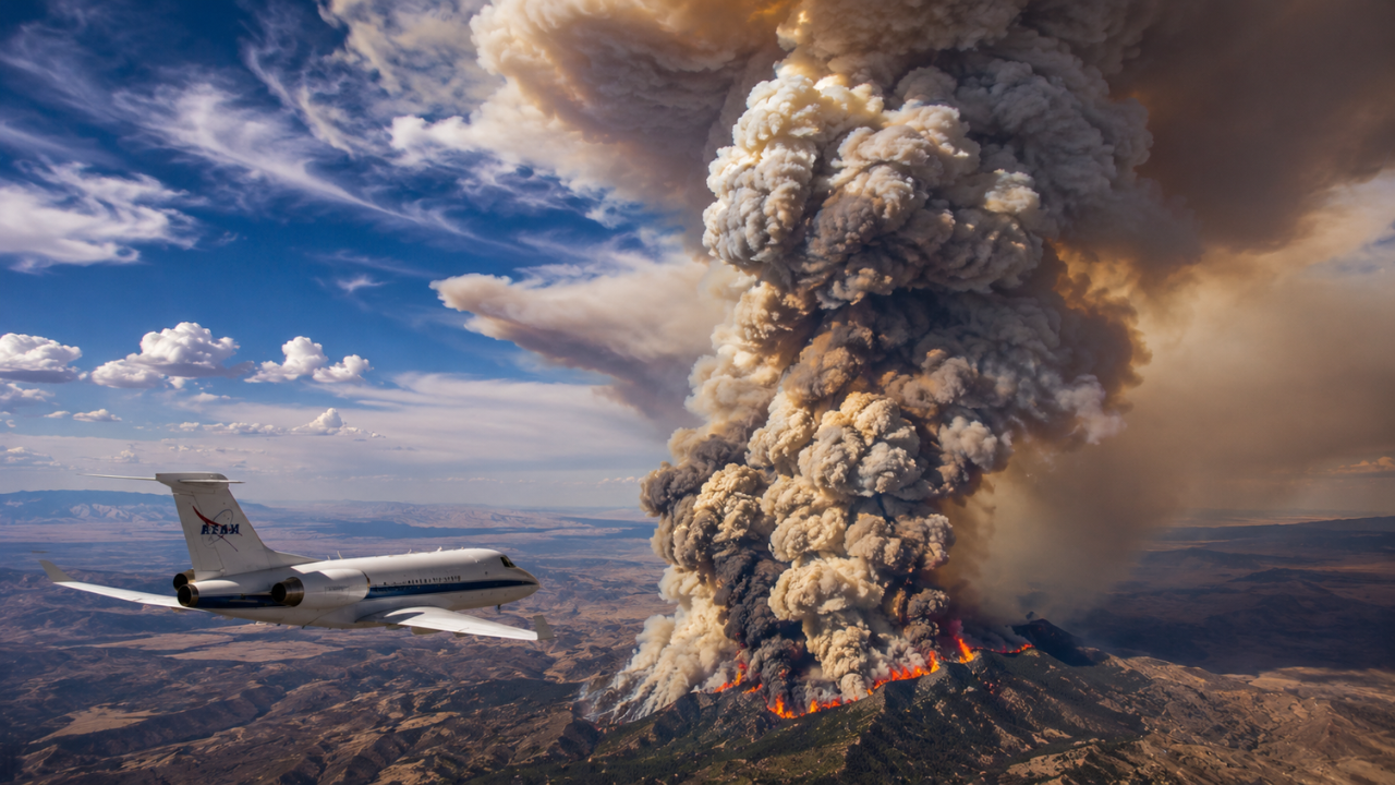
Image AI generated
Nasa aircraft chase Widemouth 2 wildfire smoke over New Mexico
The Widemouth 2 fire provided scientists with an opportunity to observe the process at close range. Lightning started the fire on July 27, 2026, but its behaviour changed dramatically on August 2, when strong winds and hot, dry conditions helped it more than double in size. The fire produced two pyroCb bursts that afternoon. NASA’s Aqua satellite later captured the towering cloud and smoke, including a visible shadow cast by the elevated plume over smoke closer to the ground.The following day, an aircraft from the INSPYRE mission travelled towards the smoke as it moved over New Mexico. The Gulfstream V aircraft, operated by NSF/NCAR, had been on the ground in Colorado when the fire intensified and was redirected towards the high-altitude plume. Its instruments sampled smoke at around 12 kilometres, or roughly eight miles, above the surface. That altitude matters because measurements there are not normally well represented in standard forecast models.
Why Nasa aircraft are flying through wildfire smoke satellites cannot sample
Satellites have already given scientists a useful way to identify pyroCbs. One method involves looking at the temperature of the cloud tops. During the Widemouth 2 event, Nasa’s Aqua satellite recorded cloud-top brightness temperatures below minus 40°C, a level commonly associated with pyroCb development. The readings indicated two separate bursts of activity and suggested that the clouds were pushing towards the top of the troposphere, with some potentially entering the stratosphere.An aircraft can do something a satellite cannot: move through the plume and collect physical measurements from the smoke itself. The INSPYRE mission, short for Injected Smoke and Pyrocumulonimbus Experiment, is using Nasa’s ER-2, NSF/NCAR’s Gulfstream V and ground-based sensors to investigate these events. The aircraft observations can add information about what is actually being carried upwards, helping researchers examine smoke at heights that are difficult to capture from the ground.
Why scientists still struggle to predict when wildfires will produce pyroCbs
PyroCbs are not produced by every wildfire, and that unpredictability is part of the problem for forecasters. Scientists are still working to determine which types of vegetation are most likely to support their formation, why some pyroCbs generate more lightning than others and why these clouds emerge from only a small proportion of fires. Forecasting their development remains difficult.There is also a wider atmospheric question. Scientists have catalogued more than 700 pyroCb events since the clouds first began appearing in the scientific literature in the early 2000s. Research cited by Nasa suggests wildfires may account for as much as 25 per cent of black carbon and organic aerosols in the lower stratosphere. The amount of material injected during an entire fire season can therefore become significant on a much larger scale, extending the scientific interest in these clouds well beyond the fires that create them.For firefighters and forecasters, the immediate concern is closer to the ground. Multiple pyroCbs can develop during the same fire, making the behaviour of a blaze harder to anticipate and complicating decisions around evacuations and firefighting. David Peterson, principal investigator for INSPYRE, said that reducing this uncertainty is a major reason the team is studying the clouds.The Widemouth 2 flights are part of that effort to fill in the gaps between what satellites can see and what forecasting models can predict. Michael Fromm of the U.S. Naval Research Laboratory described pyroCbs as clouds that continue to surprise scientists, both through their dangerous behaviour near wildfires and their longer-lasting influence high in the atmosphere.